Summary
Tehri Garhwal is one of the most important historical districts of Uttarakhand. The town of Tehri was established in 1815 by Garhwal King Sudarsh Shah as the capital of the Tehri Kingdom. After India's independence, Tehri Garhwal became a separate district on 1 August 1949. Later, Uttarkashi and Rudraprayag districts were carved out from its territory.
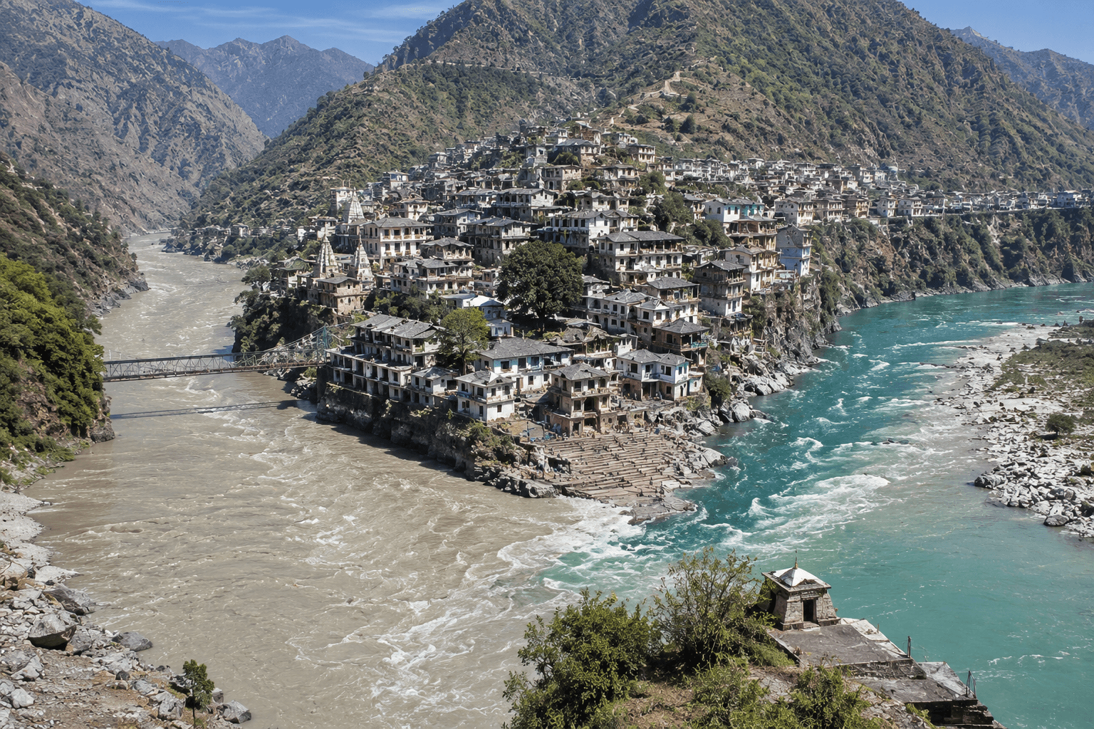
Old Tehri, located at the confluence of the Bhagirathi and Bhilangana rivers, was an important stop for pilgrims traveling to Yamunotri, Gangotri, Kedarnath, and Badrinath. However, the construction of the Tehri Dam led to the submergence of Old Tehri. To rehabilitate displaced residents, New Tehri was developed as a planned township and became the district headquarters.
Tehri Garhwal is home to several famous religious, historical, and tourist destinations. Devprayag, the sacred confluence of the Bhagirathi and Alaknanda rivers, is one of the holiest sites in Uttarakhand. Chandrabadni Temple, Chamba, Dhanaulti, Kempty Falls, Narendra Nagar, Surkanda Devi Temple, Nag Tibba, Budha Kedar, Khatling Glacier, and Vishwanath Cave are among the district’s major attractions.
Known for its rich history, spiritual heritage, scenic Himalayan landscapes, and adventure opportunities, Tehri Garhwal remains one of the most significant regions of the Garhwal Himalayas and an important destination for pilgrims, history enthusiasts, and nature lovers.
Introduction
Tehri Garhwal is one of the most historically significant districts of Uttarakhand. Known for the majestic Tehri Dam, the former Tehri princely state, the beautiful Tehri Lake, and several religious and natural attractions, this region holds a unique place in the history and culture of the Garhwal Himalayas.
The district attracts pilgrims, history enthusiasts, adventure lovers, and nature seekers from across India and abroad. Ancient temples, sacred river confluences, Himalayan landscapes, and stories connected with kings, sages, and deities make Tehri Garhwal a remarkable destination.
In this article, we will explore the complete History of Tehri Garhwal, learn about the Tehri Kingdom, Old Tehri, New Tehri, and discover the famous places that make this district one of Uttarakhand’s most important regions.
History of Tehri Garhwal
The town of Tehri was situated at the confluence of the Bhagirathi and Bhilangana rivers. Today, much of the old town has merged into the waters created by the Tehri Dam project.
Tehri was established in 1815 by Garhwal King Sudarsh Shah, who made it the capital of the Tehri Kingdom. The city became an important political and cultural center of the Garhwal region.
Following India’s independence, Tehri Garhwal was officially formed as a separate district on 1 August 1949. Prior to this, the area was known as the Tehri Princely State.
Over time, administrative changes reshaped the district:
- Uttarkashi district was carved out in 1960.
- Rudraprayag district was created in 1997.
These developments gradually reduced the geographical extent of the original Tehri region.
Old Tehri
Old Tehri was located approximately 84 kilometers from Rishikesh at an elevation of about 770 meters above sea level.
Historically, it served as an important halt for pilgrims traveling to:
- Yamunotri
- Gangotri
- Kedarnath
- Badrinath
The town flourished as a religious and commercial center before the construction of the Tehri Dam.
New Tehri
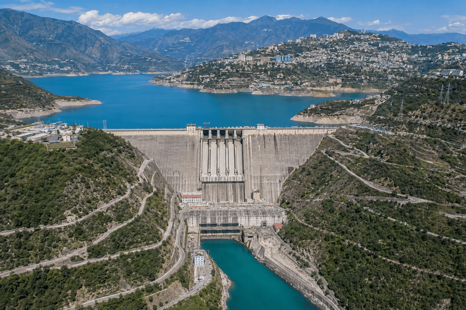
With the construction of the Tehri Dam, the government planned a new township about 24 kilometers south of Old Tehri and approximately 60 kilometers from Rishikesh.
The newly developed town was named New Tehri (Nai Tehri) and became the rehabilitation center for people displaced by the dam project.
Many families also settled in other regions, including:
For many years, Narendra Nagar served as the headquarters of Tehri district. However, after the development of New Tehri, all administrative offices were shifted there.
Today, New Tehri is a well-planned town and serves as the district headquarters.
Famous Tourist and Religious Places of Tehri Garhwal
Devprayag
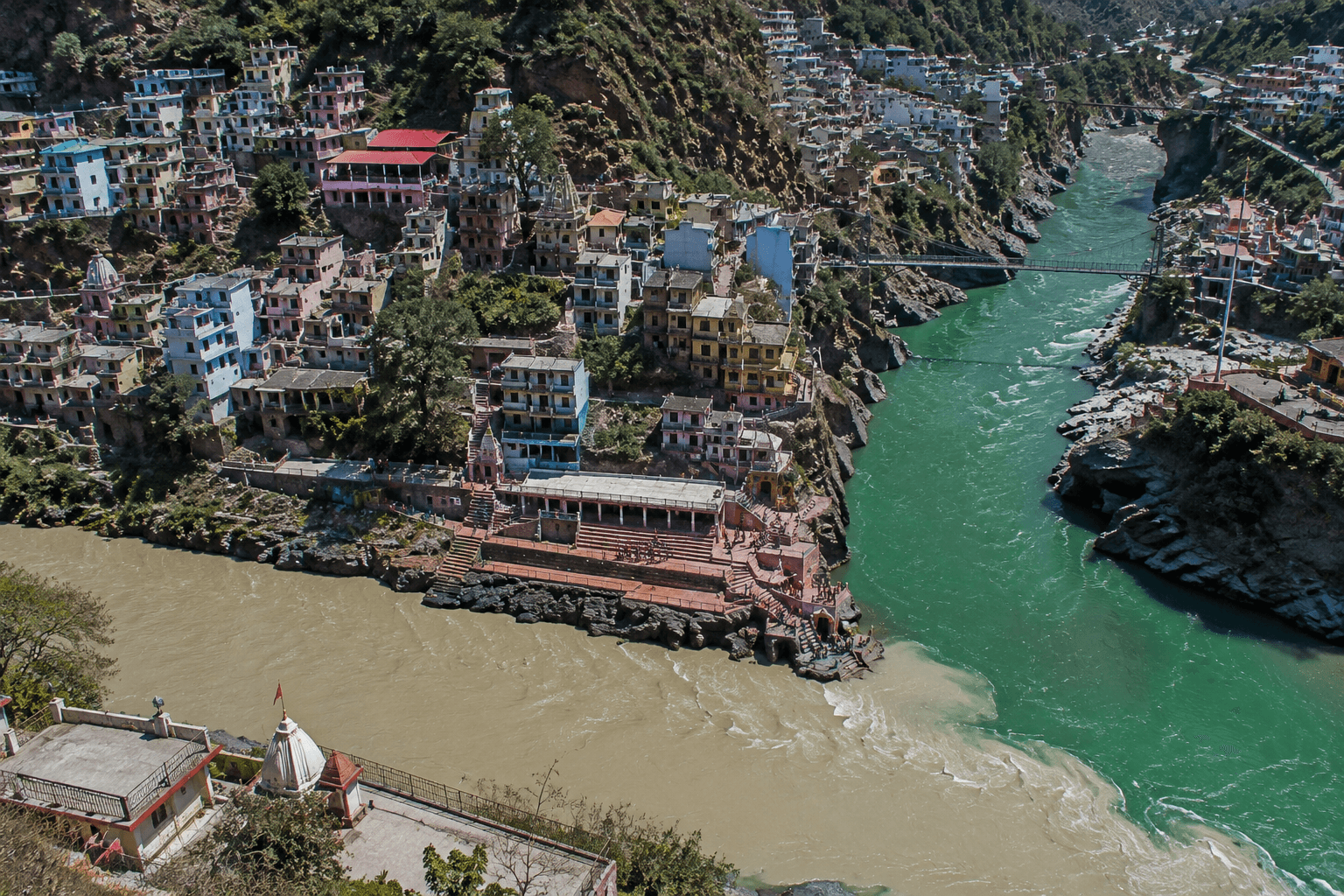
Devprayag is situated at an elevation of approximately 472 meters above sea level and is located at the sacred confluence of the Bhagirathi River and Alaknanda River.
This holy town lies on the Rishikesh-Badrinath route and is regarded as one of the most important places among the Panch Prayags of Uttarakhand.
Important features of Devprayag include:
- Two suspension bridges
- Brahma Kund
- Vashishta Kund
- Sacred confluence of Bhagirathi and Alaknanda
According to mythology, Lord Vishnu asked King Bali for three steps of land at this sacred site.
One of the unique beliefs associated with Devprayag is that crows are rarely seen in the area.
It is believed that Lord Rama visited Devprayag after defeating Ravana. The famous Raghunath Temple, dedicated to Lord Rama, stands as a reminder of this tradition.
The temple, built in the Dravidian style, was later renovated by Adi Shankaracharya. An inscription from the reign of Garhwal ruler Prithvi Shah can also be found at the temple.
Devprayag is additionally known by the names:
- Sudarshan Kshetra
- Indraprayag
According to legend, Sage Dev Sharma performed intense penance here during Satyuga, leading to the region being named Devprayag.
The confluence is also considered highly auspicious for Pind Daan rituals.
Chandrabadni Temple
The famous Siddhpeeth Maa Chandrabadni Temple is situated on Chandrakoot Mountain.
The temple is located on the Tehri–Srinagar motor road and can be reached after an approximately 8-kilometer trek from Kandikhal.
A natural Shri Yantra is established at this sacred shrine, making it an important spiritual destination for devotees.
Chamba
Chamba is located at an altitude of 1,676 meters above sea level.
The town lies:
- 60 km from Mussoorie
- 48 km from Narendra Nagar
Chamba offers breathtaking views of the snow-covered Himalayan peaks and the sacred Bhagirathi Valley.
Due to its strategic location connecting Mussoorie, Rishikesh, Tehri, and New Tehri, Chamba has developed as an important regional center.
Dhanaulti
Dhanaulti is situated on the Mussoorie-Chamba road.
Distances:
- 24 km from Mussoorie
- 29 km from Chamba
Surrounded by dense forests of:
- Deodar
- Rhododendron
- Oak
Dhanaulti is known for its peaceful atmosphere and untouched natural beauty.
Kempty Falls
Located approximately 15 kilometers from Mussoorie on the Mussoorie-Yamunotri road, Kempty Falls stands at an elevation of about 1,215 meters above sea level.
Kempty Falls is among the largest and most beautiful waterfalls associated with the Tehri region.
The waterfall is situated within a picturesque valley and is surrounded by towering mountains from all directions.
Narendra Nagar
Narendra Nagar is situated at an altitude of 1,129 meters above sea level and lies approximately 14 kilometers north of Muni Ki Reti (Rishikesh).
Historically, Narendra Nagar served as the capital of the Garhwal State.
Until recent decades, it also functioned as the headquarters of Tehri Garhwal district before the administrative center was shifted to New Tehri.
Surkanda Devi Temple
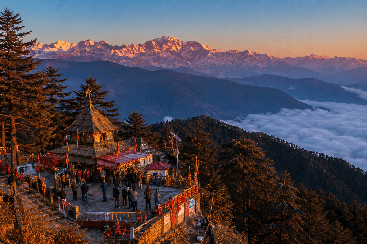
Surkanda Peak is located at an elevation of approximately 2,750 meters above sea level.
The area is famous for the revered Surkanda Devi Temple, which attracts thousands of pilgrims every year.
The temple is situated around 8 kilometers from Dhanaulti.
Nag Tibba
Nag Tibba stands at an elevation of 3,048 meters above sea level.
The region offers excellent opportunities for:
- Trekking
- Hiking
- Camping
- Adventure tourism
Dense forests and spectacular Himalayan views make Nag Tibba one of the most popular trekking destinations in Uttarakhand.
Budha Kedar
Budha Kedar is located approximately 31 kilometers from Ghansali Block.
This sacred site is known for its ancient and magnificent temple dedicated to Lord Kedarnath.
The temple holds immense religious significance and attracts devotees throughout the year.
Khatling Glacier
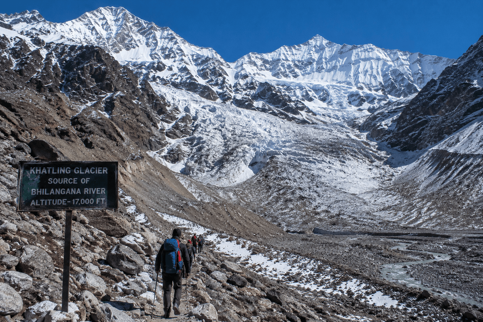
Khatling Glacier serves as the source of the Bhilangana River.
To its right lies the famous Doodh Ganga Glacier.
Nearby is Masar Tal, situated approximately 6 kilometers from Khatling Glacier.
The glacier region is renowned among trekkers and adventure enthusiasts for its stunning alpine scenery.
Vishwanath Cave
Vishwanath Cave is situated on Vishwanath Mountain along the Hindav Patti-Kedarnath route of the district.
According to local traditions:
- It is regarded as the meditation site of Adi Shankaracharya.
- The cave is associated with Guru Vashistha.
- Vishwanath is believed to have manifested at this sacred location.
The cave remains an important spiritual and historical destination in Tehri Garhwal.
Conclusion
Tehri Garhwal is a unique blend of history, spirituality, culture, and natural beauty. From the legacy of the Tehri Kingdom and the transformation brought by the Tehri Dam to the sacred confluence of Devprayag, the serene forests of Dhanaulti, the adventurous trails of Nag Tibba, and the spiritual sites of Chandrabadni, Surkanda Devi, Budha Kedar, and Vishwanath Cave, every corner of the district tells a remarkable story.
Whether you are a history enthusiast, pilgrim, nature lover, or adventure seeker, Tehri Garhwal offers an unforgettable experience in the heart of the Garhwal Himalayas.
1.Who founded Tehri Garhwal?
Tehri was established in 1815 by Garhwal King Sudarsh Shah and became the capital of the Tehri Kingdom.
Tehri Garhwal is famous for Tehri Dam, Tehri Lake, Devprayag, Surkanda Devi Temple, Nag Tibba, Dhanaulti, and its rich historical heritage.
Old Tehri was submerged due to the construction of the Tehri Dam, and many residents were relocated to New Tehri and other towns.
The Bhilangana River originates from Khatling Glacier.
Devprayag is the sacred confluence of the Bhagirathi and Alaknanda rivers and is considered one of the holiest places in Uttarakhand.
Nag Tibba is situated at an elevation of approximately 3,048 meters above sea level.
Surkanda Devi Temple is located near Dhanaulti at an elevation of around 2,750 meters.
New Tehri is a planned township developed for the rehabilitation of people displaced by the Tehri Dam project and currently serves as the district headquarters.
Releted Post:-
- Tourism and Religious Places Haridwar Part 1
 Tourism and Religious Places Haridwar Haridwar Tour Place I will tell you today about ‘Hariddhar Tour Palace’ which is also called Dwar of Uttarakhand, from where Uttarakhand has also started, the place from where the journey of Char Dham starts is the place ‘Hariddhar Tour Palace’ from where you can visit. can understand uttarakhand… Read more: Tourism and Religious Places Haridwar Part 1
 - Tourism and Religious Places Haridwar (Part 2)Tourism and Religious Places Haridwar (Part 2) In the last part we learned about the old history of Haridwar, today we will see those places about which people have belief and faith, if you want to read the old post then its link is given below. The five places which have been mentioned as important… Read more: Tourism and Religious Places Haridwar (Part 2)
- Medieval Period of UttarakhandMedieval Period of Uttarakhand The medieval period of Uttarakhand witnessed the rise and fall of powerful dynasties, the construction of strategic forts, and continuous political struggles in both Kumaon and Garhwal. This era is remembered for the Katyuri rule, the expansion of the Chand dynasty, and the establishment of the Parmar (Panwar) dynasty in Garhwal.… Read more: Medieval Period of Uttarakhand
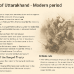
- History of Uttarakhand (Modern Period)History of Uttarakhand – Modern Period The History of Uttarakhand – Modern Period highlights two major phases: the Gorkha rule and the British rule. This period is marked by warfare, political changes, important treaties, and the rise of a new administrative structure that shaped modern Uttarakhand. Let us understand these events in detail. Gorkha Rule… Read more: History of Uttarakhand (Modern Period)
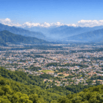
- What Is Dehradun Famous For? Complete History & Tourist GuideDehradun, the capital of Uttarakhand, is famous for its natural beauty, temples, caves, waterfalls, history, and nearby hill stations like Mussoorie.