🌾 Uttarakhand Agriculture & Land System
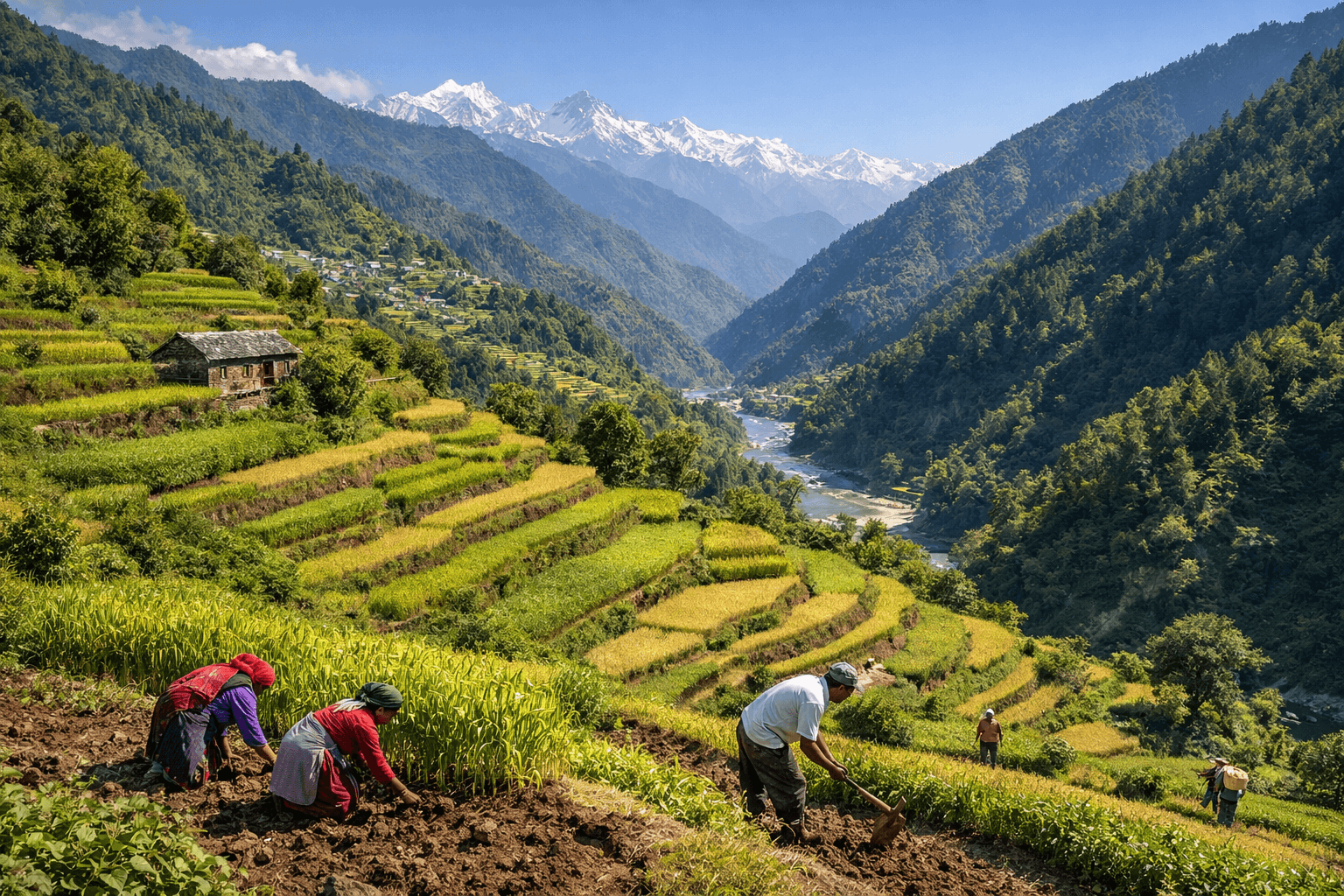
Uttarakhand is primarily an agricultural state where nearly 69.77% of the population lives in rural areas and depends on the primary sector such as agriculture, forests, herbs, and allied activities. Agriculture has shaped the economic and social structure of the state for centuries. However, geographical diversity, migration, and land reforms have deeply influenced farming patterns over time.
🏞️ Land Reforms and Land Management in Uttarakhand
Before British rule, land settlements were based on the principles of Manusmriti. During the Gorkha period (1812), a structured land settlement was introduced. After the British took control:
- 1815–16: First British land settlement
- Total Settlements Conducted: 12
- 1815 (Kumaon) under Gardner
- 1816 (Garhwal) under Tell
- Land revenue fixed at ₹85,195
🔹 Wicket Settlement (1863–73)
The 9th and most important settlement was conducted under G.E. Wicket. For the first time, a scientific method was adopted.
Mountain land was divided into five classes:
- Talau
- Uprau Awal
- Uprau Doyam
- Ezran
- Kantil
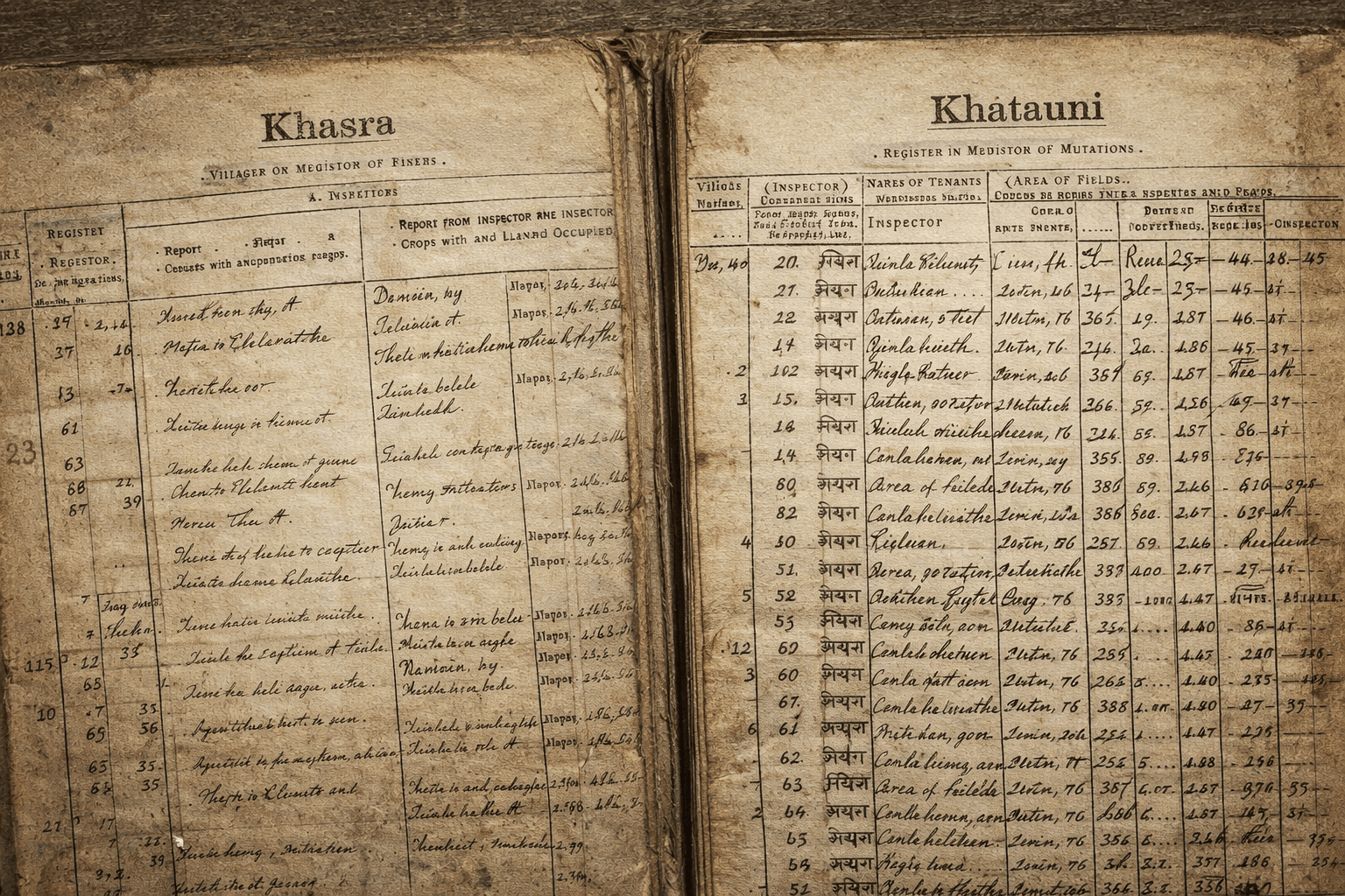
Accurate land records such as Khasra, Khatauni, and Shajra were prepared.
🔹 Final British Settlement (1928)
The 11th settlement was completed under Ibbetson in the Garhwal division.
🔹 After Independence (1960–64)
The 12th settlement focused mainly on updating land records. The Uttar Pradesh government made holdings up to 3-1/8 acres liable for land revenue, which affected nearly 90% of farmers.
As a result:
- Migration increased
- Fields were left fallow
- Barren land expanded
- Agriculture shifted from self-sufficient to food-importing
Before state formation:
- Active holdings: 9.26 lakh
- Reduced to: 8.91 lakh
- Around 35,000 hectares became barren
There is a strong need for fresh land settlement policies and redistribution of unused land.
📏 Measurement of Agricultural Land
In Uttarakhand:
- 1 Nali = 200 square meters
- 50 Nali = 1 hectare (10,000 sq. meters)
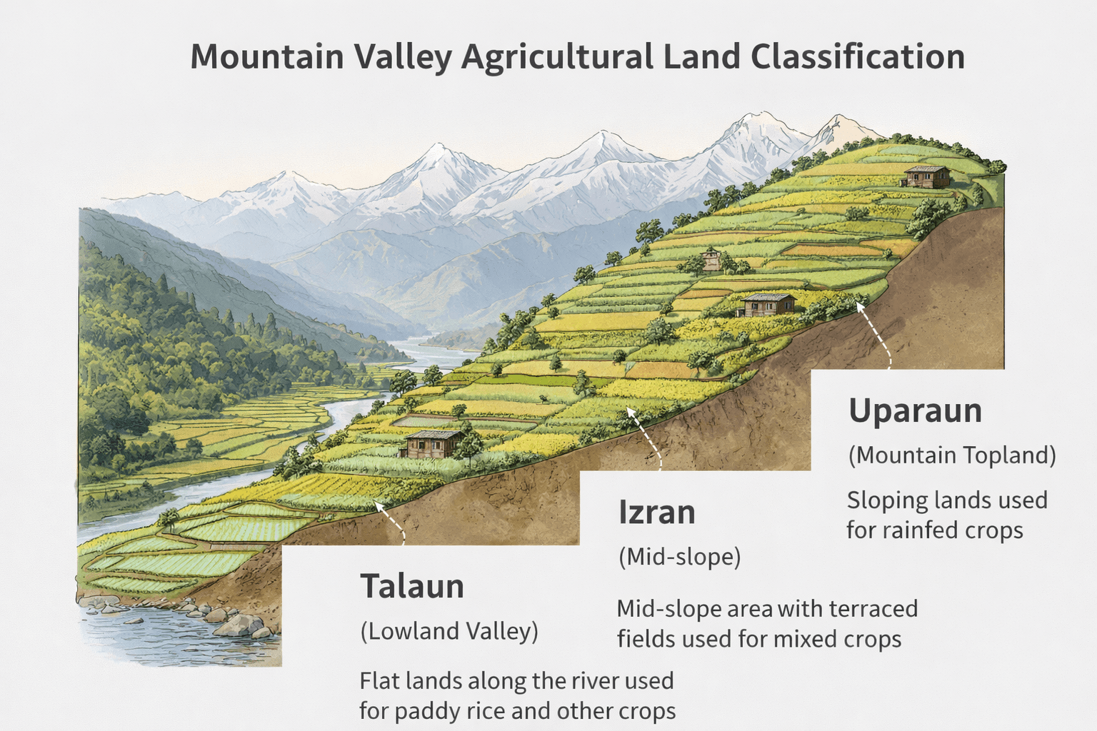
🌄 Mountain Agricultural Land Classification
In plains, land is classified by soil type. In hilly areas, irrigation availability determines classification.
1️⃣ Talaun Land
- Located in valley floors
- Best irrigation system
- Three times more productive than upland
2️⃣ Uparaun Land
- Unirrigated uplands
- Two types: Awal (better) & Doyam
3️⃣ Izran Land
- Rocky and forest-adjacent land
- Least fertile
Other local terms:
- Gharya – land near village
- Bichlaya – land in middle of village
- Budya – land near forest
🚜 Types of Farming in Uttarakhand
🌿 Contour Farming
Farming along contour lines to conserve soil and moisture.
🪜 Terraced Farming
Steps are created on slopes to prevent soil erosion.
🔥 Shifting Cultivation (Jhuming)
Practiced by some tribal communities. Land is cleared, cultivated, and later abandoned when fertility declines.
🌾 Crop Production in Uttarakhand
Three cropping seasons exist:
| Season | Sowing | Harvest | Major Crops |
|---|---|---|---|
| Rabi | Oct–Dec | Mar–Apr | Wheat, barley, gram, peas, mustard |
| Kharif | May–July | Sept–Oct | Rice, mandua, maize, jhangora |
| Zaid | Summer | Short duration | Vegetables, pulses |
Kumaon division has more agricultural land compared to Garhwal division.
🌾 Major Crops of Uttarakhand
🌾 Wheat
- Main crop
- 33% agricultural land
- Major districts: Dehradun, Udham Singh Nagar, Haridwar
🍚 Rice
- Second major crop
- 21.6% land area
- Major districts: Udham Singh Nagar, Haridwar, Nainital
🌱 Sugarcane
- 6% cultivable area
- Maximum production: Udham Singh Nagar
🌽 Maize
Produced in Dehradun, Almora, Pithoragarh, Rudraprayag
🌾 Mandua (Finger Millet)
Major hill crop
High export demand (including Japan)
🌻 Mustard
Cultivated in plains districts
🌱 Pulses
70% pulse production comes from Kumaon districts.
📊 Challenges in Uttarakhand Agriculture
- Increasing migration
- Rising fallow land
- Fragmented land holdings
- Climate change impact
- Irrigation limitations in hills
Sustainable land management and policy reform can strengthen rural livelihoods.
Nearly 69.77% of Uttarakhand’s population lives in rural areas and depends on agriculture, forests, herbs, and other primary sector activities.
The Wicket Settlement (1863–73) was the 9th and most important British land settlement. It introduced scientific land classification and prepared detailed records such as Khasra and Khatauni.
Agricultural land in Uttarakhand is measured in Nali. One Nali equals 200 square meters, and 50 Nali equals 1 hectare (10,000 square meters).
Mountain land is divided into Talaun (irrigated valley land), Uparaun (upland unirrigated land), and Izran (rocky forest-adjacent land).
The major crops include wheat, rice, sugarcane, maize, mandua (finger millet), mustard, and pulses. Wheat is cultivated on the maximum area.
Migration, fragmented holdings, and land revenue policies have led to increasing fallow and barren land, especially in mountainous regions.